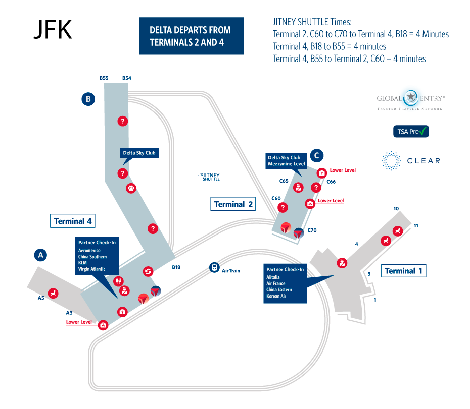
NEW YORK CITY -JOHN F. KENNEDY (JFK) INTERNATIONAL AIRPORT MAP
Receiving more international passengers than any other airport, the JFK International Airportopens in a new window is the gateway to the U.S. And, it’s quite a first impression with its elevated light-rail system that makes traveling between terminals a piece of cake. JFK Airport encompasses Terminal 2 and Terminal 4, with ground or rail transport between each. Review the JFK Airport map below for exact details on gates, shops, and baggage claim areas.


JFK International Airport Transportation
- Distance from City Center: 30-60 minutes
- Ground Transportation Options: Taxi, Bus, Shuttle Services
- Average Taxi Fare to the City Center: Flat rate from JFK: For trips between Manhattan and JFK International Airport, the flat fare is $52,00 plus any tolls using Rate Code 2 on the meter. A NY State Tax Surcharge of $.50 will be added to each trip.
- Average Bus/Train Fare to City Center: $8,50-$15
- Take a look at the JFK Terminal Improvements
- Book Flight to New York JFK